Wednesday, November 27, 2019

November 29th, 2019 - Romero Pools and Romero Springs - Cancelled due to Rain


Hike Description: This hike is an out and back up Romero Canyon Trail to some picturesque
pools in the Catalina Mountains. The difficulty increases with the length of the hike. 

Long Hike: to Romero Spring 10 miles - B+

Short Hike: To Romero Pools 6 miles - B


Alltrails description and map of the hike

Directions: Take 1-10 south and take Exit 240. Turn left (east) onto Tangerine Road. In 13.5 miles turn right onto Oracle Road, then in 0.2 miles turn left into Catalina State Park. At the Guard House purchase a car pass ($7.00). Proceed to the parking lot on the left. 61 miles. 


Google Maps to Romero Pools Trailhead

Casa Grande Mountain Hike

Casa Grande Mountain Hikers leaver the Palm Creek Parking Lot at 8:00 and arrive back to the park before lunch. 


Tuesday, November 19, 2019

November 22, 2019 Romero Pools - Catalina State Park - Cancelled

Cancelled due to heavy rains for two days prior. Safety issues with water in the washes and slippery rocks.

Hike Description: This hike is an out and back up Romero Canyon Trail to some picturesque pools in the Catalina Mountains. The difficulty increases with the length of the hike.

Long Hike: To Romero Spring 10 miles - B+

Short Hike: To Romero Pools 6 miles - B


Directions: Take I-10 south and take Exit 240. Turn left (east) on Tangerine Rd.
In 13.5 mi. turn right onto Oracle Rd, then in 0.2 mi. left into Catalina State Park.
At the Guard Shack purchase a car pass. ($7). Proceed to the parking lot
on the left. 61 miles.
32°25’31.86W, 110°54’30.54N

Google Maps to Romero Pools Trailhead

Casa Grande Mountain Hike
Casa Grande Mountain Hike leaves Palm Creek Parking Lot at 8:00 and arrives back at the park before lunch. 


Tuesday, November 12, 2019

November 15, 2019 Picket Post Mountain Loop and Picket Post - Arnett Creek - Out and Back


Picket Post Trailhead 

Long Hike - Picketpost Mountain Loop - The hike starts from the east side of the parking area to the left of the large Arizona Trail sign. This trail climbs to the east and across a wash towards the base of Picketpost Mountain. It is fairly shaded in the first part of the hike. About 1/2 way around the mountain the trail becomes rockier, with less shade. 9.1 miles. Leader - Dave
Short Hike - The out and back hike will start on the same trail as the long hike, stop for lunch and go back the way we came. Leader - Jerry

Casa Grande Mountain Hike

Skip and Penny went on a 4 mile hike at the north side of Casa Grande Mountain.


We can see both groups in this picture


Short Hike Group + Nancy


This large Saguaro marked the end of our short Hike - this was 4.2 miles.
We headed back the way we came.


Picket Post Mountain Loop - Data for Long Hike

Picket Post Mountain Loop - Long Hike

Graph from Picket Post Mountain Loop


Data for Arnett Creek from Picket Post Trailhead - Short Hike

Arnett Creek from Picket Post Trailhead - Short Hike - Out and Back - 8.4 miles

Graph for Arnett Creek from Picket Post Trailhead - Short Hike 

Description of the hikes:

Casa Grande Mountain Hike - Will leave the parking lot at 8:00 and will be back before lunch. Directions to Casa Grande Mountain are on the Test your Ability tab on the Right.
Picket Post Loop Trail from All Trails Website


Driving Distance, Time and Directions to Picket Post Trailhead  
Go right at the park exit and north on Henness Road 0.7 miles to Cottonwood.
Turn right and go east 2.8 miles to N Overfield Road. Turn left and go north 3.9 miles to
Woodruff Road. Go right and east 1.9 miles to Signal Peak road, turn left and go north 2.9 miles to
Hunt Highway. Turn right and go east 6 miles to SR79 at the dead end. Turn left and go north on
highway SR79 for 12.7 miles to Highway 60. Go right on Highway 60 for 9 miles and turn right at the
Picketpost Trailhead sign onto a dirt road. Drive 0.4 miles to a dead-end and Picketpost Trailhead
sign. Turn left and proceed for 0.6 miles. The road turns right into the parking area. It is 55 miles
and took 1:05 minutes. There are pit toilets.

Google Maps to Picket Post Trailhead


Saturday, November 9, 2019

November 8, 2019 Wild Mustang and Wild Burro - Starting at Upper Javelina Spur Trail.


We started the hike at 9:20 went we walked across the parking lot 
toward the hotel to the start of the trailhead.

We walked along the Hotel Spur Trail and turned left on the second Hotel Spur Trail sign across from the Flagpoles. This leads to the Upper Javelina Spur Trail. 


We started to climb shortly up many switchbacks and around large rocks shortly after getting onto the Upper Javelina Spur Trail. Great views of the surrounding landscapes. 


We descended into a wash before we immediately started climbing toward a lookout where the signs explained the mountains we could see.


After a few more climbs we started walking along a ridge at 4000 feet. The Yucca Plants, Chain Fruit Cholla Cactus and Ocotillo dominated the rocky landscape.


There is a gate to open as we came up to the ridge. 


On top of the ridge, we started heading back toward the trailhead after we passed the sign where the Wild Burro meets Wild Mustang. We followed Wild Burro to the right. 


Another Gate to open as we head back down Wild Burro. 
 

We at Alamo Springs at 12:20, We stopped for lunch where there is a bench and plenty of rocks to sit on. 


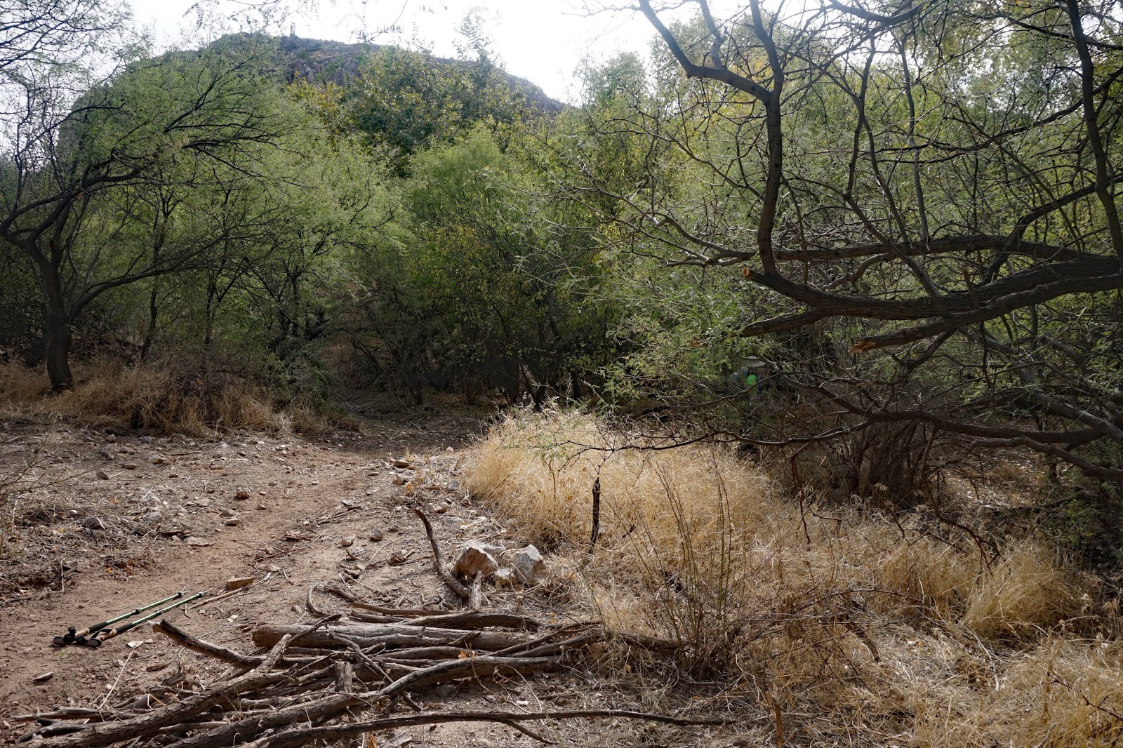
The Wild Burro trail continues to make a loop down. We started hiking down a steep grade to a wash. 


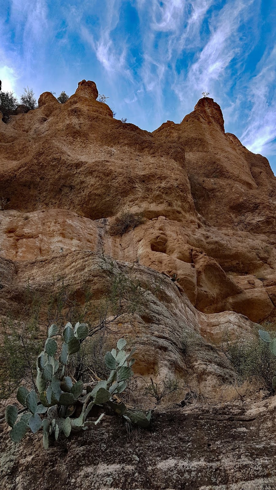
From this wash, we turned back up a short trail to another trail that took us down a steep grade toward the rock structures and tank near another wash. 


This wash took us back to the trailhead. We followed the Purple Wild Burro Signs to stairs.  


Another Great Hike


Arrived at the Trailhead at 2:15. 


Short Description of Hike
This hike starts up the Upper Javelina Spur Trail up a steep trail that winds through large rocks. Once at the top there is a wide vista and the trail evens out as it goes across a ridge. This trail is a loop that winds down a steep decline into a canyon and eventually comes to a wash. It has a variety of landscapes. The hike is 8 miles with high altitude gains and losses.

Picture of Wild Burro Trailhead - Google Maps

Google Maps to Wild Burro Trailhead

Directions to trailhead: Go southeast on I-10 to exit 240, Tangerine Road, turn left and follow Tangerine Road for 5 miles. Turn left on Dove Mountain Blvd and follow it for 4.6 miles until you come to a roundabout. Take the first right off the roundabout and continue a short way to the Guardhouse. After checking with the gate guard, proceed up the road for 0.8 miles to the third right-hand turn and go right at the sign for the trailhead and park in the dirt lot. It is 5.4 miles and took 58 minutes.


This hike starts across the street from the Parking Lot.