Friday, December 17, 2021

Dec 17, 2021 Photos for Dixie Mine


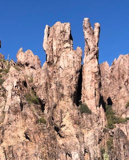
This is an easy to moderate hike of approximately 5.5 miles total, out and back, to the mine at the McDowell Mountain Regional Park. We park outside of a gated community and walk approximately 10 minutes to the trailhead. The parking facilities, however, are limited, with about 22 spaces, but we have never had a problem in the past! The trail setting is really beautiful and the trail is generally smoother than most. Small hills with interesting rock formations and many saguaros. There are no pit toilets but on the trail, there are plenty of bushes. We will view the old mine from the top looking down into it, then the mine entrance itself, some petroglyphs, and hopefully see the fountain at Fountain Hills spew 300-560 feet into the air. There is a $2.00 cash fee to hike the trail.

Directions: Take I-10 north to the 202 east. The 202 east to the 101 north to Shea Blvd, exit 41. Stay on Shea Blvd to North Palisade and make a left. Continue on North Palisade to North Manzanita Lane and again, make a left. North Manzanita turns into Sunridge Dr. which turns into Mountain Parkway which is also East Golden Eagle Blvd. (Distance approximately 70 miles, 1 hr. 15 min)

(GPS: 14597 E Golden Eagle Blvd.) 

Jerry's Cell

307-630-0252

John's Cell

207-446-0650 

Saturday, December 4, 2021

Miner's Needle photos Dec 3, 2021


 This is an easy to moderate hike of 5.6 miles in the Superstition Wilderness. The trail starts at the NE end of the Peralta Trailhead parking lot and we take trail #104, The Dutchman's Trail. 

The trail goes up and over the ridge directly ahead, looping around the nose of it to a saddle and into a broad valley. The trail goes generally in an easterly direction across the valley until after about one hour and twenty minutes and 2.6 miles. Here you will see Miner's Needle. This trail meets the Coffee Flat Trail at the junction. As this point, we travel north a short distance for a better view of Miner's Needle and have lunch. We return back on the same trail. Pit toilets are available at the trailhead. 

Directions, Distance and Time to the Trailhead:  Go north on Hwy 79 out of Florence. Drive west on Hwy 60 at Florence Junction. About 8 miles from the junction, at milepost 204.1, is the frist traffic light and a sign, Peralta Trail. Turn right as this light and proceed trhought the residential area and past the school, then on the gravel road ot the trailhead at the end, about 7 miles. It is 62 miles and took 1 hour and 1 mintues. 

All hikers meet at the central mailboxes at about 7:30 am to sign up and pay their membership fee of $10.00 per season, sign a waiver, receive their hiking sticker and have vaccination cards validated. We leave at 8:00 am sharp and return approximately 2:00 -3:30 pm.