Showing posts with label Picketpost. Show all posts

Wednesday, February 24, 2021

Picketpost Loop and Casa Grande Mountain Hike - February 26, 2021

Casa Grande Mountain Hike Group Picture


Picketpost Mountain Hike


Mary Anne's Pictures


Trail map and elevation From John Robichaud's site on All Trails. 


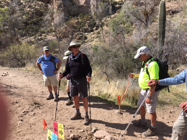
This is a scenic hike that passes the base of Picketpost Mountain and then crosses a number of low hills to some higher hills and deep canyons. We will be hiking clockwise. It may be a loop or an in-and-out as we want to keep the distance hiked a little less than 8 miles. Pit toilets are available at the trailhead. The level of difficulty is a B- or Moderate.

Directions: Again, right turn out of Palm Creek and then another right at Cottonwood. Then, the same back roads we did last week until you get to Hunt Highway. Right turn here and continue to Florence Junction. From Florence Junction go right on Highway 60 toward Globe for 9 miles to milepost 221.5 and turn right at the Picketpost Trailhead sign. Drive .4 miles and then turn left at the sign onto FS Road 310. Proceed for .6 miles into the parking area. It is 55 miles and took 1:05. (GPS: Globe, AZ)

Short Hike: Short hike around Casa Grande Mt. led by Reno and Denis. Their hike averages 3 - 4 miles and they are usually back to Palm Creek by noon. Leaves from the central mailboxes same time as the longer hike, 8 a.m., and must have a Palm Creek Hiking Club Membership Waiver. Try to be at the mailboxes around 7:45 a.m. to secure waivers.

 Upcoming Hikes:

March 5, 2021: 

A hike in the beautiful Tortolita Mountains of Marana at the Dove Mountain Resort. The exact trails to be determined next week but it will be a loop of approximately 6.5 miles and include petroglyphs, cisterns and an old homestead rock house.

March 12, 2021:

This is an interesting hike around Pass Mountain in the Goldfield Mountains at Usery Mountain Regional Park. There is a shallow climb around the west, north, and east side of the mountain to a saddle, then a steep descent to the valley and around the south end of the mountain and back to the trailhead. It has some good views of the fountain at Fountain Hills, the Superstition Mountains and the surrounding valleys. The hike is a fairly easy loop but long at 7.5 miles.

Remember if for some reason a hike must be cancelled, you will receive an email by 6 a.m. Friday morning!

Jerry's Cell 307-630-0252

John's Cell 207-446-0650


Click on the link below to check out Nancy's Blogspot; (pictures and information from the San Tan Hike last week!   http://palmcreekhikers3.blogspot.com/


Wednesday, February 19, 2020

February 21, 2020 Picketpost Loop and Arizona Trail to Picketpost Loop - Out and Back.


Picketpost Mountain


Long Group Picketpost Loop - Counterclockwise 9.1 miles. John R. lead this group of 18 hikers. 


The light aqua colour at the bottom shows the Arizona Trail where the medium hikers went in relation to the Picketpost Loop. 


Medium Hike - Arizona trail to the Picketpost Loop - Out and Back. 7.1 miles


Picketpost - Arizona Trail - out and back

Remember to bring lunch and lots of water, the weather is hot.
We need Drivers for both hikes.

Driving Distance, Time and Directions to Picket Post Trailhead 
Go right at the park exit and north on Henness Road 0.7 miles to Cottonwood.
Turn right and go east 2.8 miles to N Overfield Road. Turn left and go north 3.9 miles to
Woodruff Road. Go right and east 1.9 miles to Signal Peak road, turn left and go north 2.9 miles to Hunt Highway. Turn right and go east 6 miles to SR79 at the dead end. Turn left and go north on highway SR79 for 12.7 miles to Highway 60. Go right on Highway 60 for 9 miles and turn right at the Picketpost Trailhead sign onto a dirt road. Drive 0.4 miles to a dead-end and Picketpost Trailhead sign. Turn left and proceed for 0.6 miles. The road turns right into the parking area. It is 55 miles and takes 1:05 minutes to drive. There are pit toilets.

Google Maps to Picketpost Trailhead

Casa Grande Mountain Hike
Casa Grande Mountain Hike leaves the Palm Creek Parking Lot at 8:00 and arrives back to the Park before lunch. Bring lots of water as it may be a hot day.

Proposed next hikes- Schedule may change.

Feb 28 - Bear Canyon to Seven Falls - Sabino Canyon - We will check out the ticket situation for the smaller, shorter tram for the medium hikers. 
March 6 - American Flag Trail near Oracle
March 13 -14 - Weekend Chiricahua hikes.
Nancy’s cell: 403-896-9899 
Note: These hikes are designed to be an outing, not a race. Hikers are encouraged to hike together, socialize, and enjoy the fresh air and exercise, stopping as necessary to rest. To assure all hikers are accounted for, drivers will make sure that all the same hikers they take return with them.