Showing posts with label December 2019. Show all posts
Showing posts with label December 2019. Show all posts
Thursday, December 26, 2019
December 27, 2019 - Hike Cancelled due to rain
Due to cool temperatures and rain, the hike this week is cancelled.
Saturday, December 14, 2019
December 20, 2019 Black Mesa Loop and Garden Valley/Hackberry Spring Loop- First Water Trailhead
The Long hike was Black Mesa Trail. Starting at First Water Trail then turning right to Dutchman #104 and returning on Black Mesa Trail and back on First Water to the trailhead- 9.2 miles. Mike was the leader.
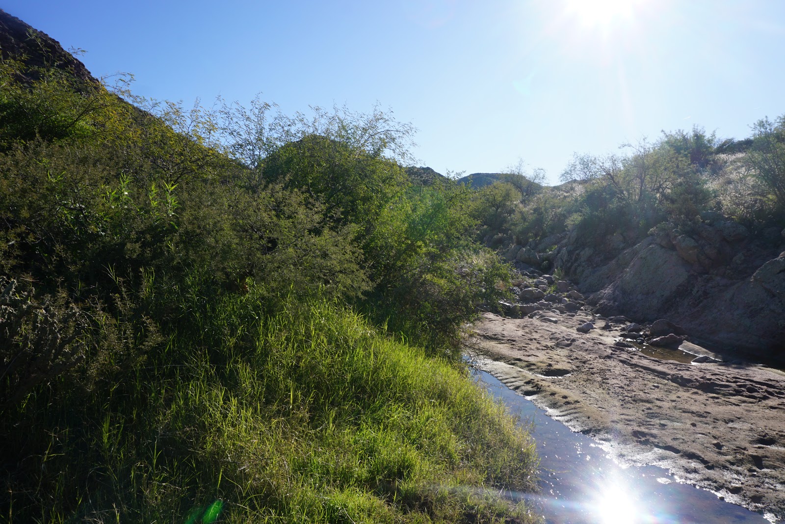
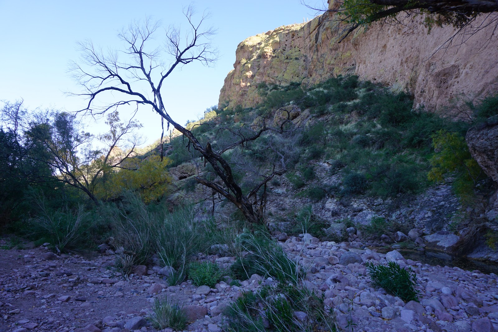
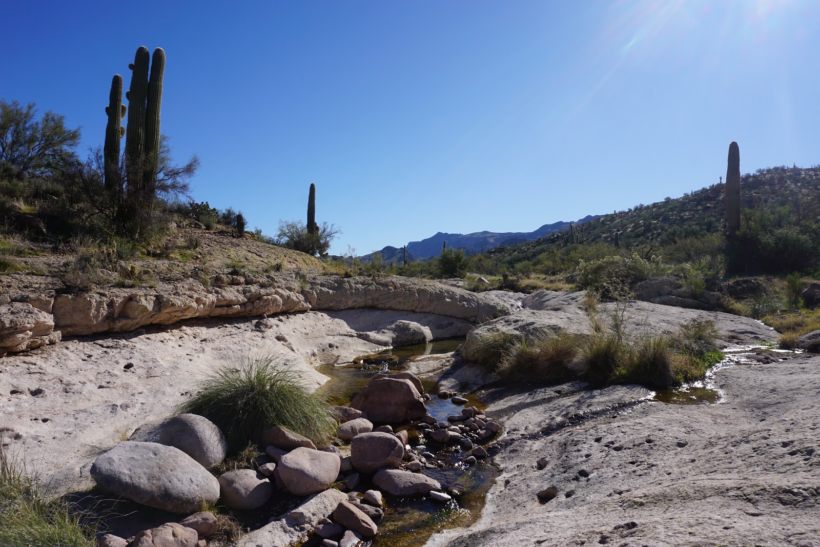
The Medium Hike was Hackberry Spring Loop, starting at First Water and turning left at the Black Mesa, First Water Junction to the Hackberry Spring Trail and continuing into the Valley and following a creek bed which comes out at the corrals and meets back to the First Water trail then back to trailhead - 6 miles. Nancy was the leader.
The Short hike was a trail or trails on Casa Grande Mountain - 4.4 miles. Skip was the leader.


 |
| Black Mesa Track |
 |
| 9 Miles |
 | ||
Black Mesa Graph - Elevation
|

 |
| Hackberry Spring - Elevation Graph |
 |
| 6 miles - Hackberry Springs |
Hackberry Springs Loop & Garden Valley - 6 miles. Beautiful scenic trail of canyons,
bluffs and a hike along a spring. Must have good tread and shoe support to maneuver
the rocks along this trail.
bluffs and a hike along a spring. Must have good tread and shoe support to maneuver
the rocks along this trail.
Driving Directions: From Palm Creek go right out of the park gate to Cottonwood,
turn right. Drive 3 miles then turn left on Overfield Road and drive 4 miles to Woodruff
Road and turn right. Drive 2 miles then turn left onto N Signal Peak Road. Drive 3.6
miles to Highway 87 which turns into 287 for another 2.9 miles. Turn left at the lights to
Attaway Road and drive for 3 miles, then turn right onto W Hunt Highway. Drive 5.6 miles
to Highway 79. Turn right on Highway 79 and drive to the junction of Highway 60. Turn
left and merge onto Highway 60. On Highway 60 drive 13 miles (three miles past
King’s Ranch). Just past Mountain View road bear right on E Old West Hwy (exit 199).
On E Old West Highway turn right at the stop sign, then bear left continuing on Old West
Highway to the traffic light on Tomahawk Rd. Turn right going northward for 2 miles until
you come to the junction of Hwy88. Turn right. Proceed past the entrance to Lost
Dutchman State Park, a short distance to a signed road “First Water Trailhead”.
Turn right on this dirt road and proceed cautiously for 2 1/2 miles, past a staging and
parking area for horses and trailers, to the end of the road where there is a good parking
area. Pit toilets available. Driving distance is 63 miles each way.
Casa Grande Mountain Hike
Casa Grande Mountain Hike leaves the Palm Creek Parking Lot at 8:00 and arrives back
to the Park before lunch. Bring Lots of water as it may be a hot day.
to the Park before lunch. Bring Lots of water as it may be a hot day.
Next Hikes:
Dec 27 - Pass Mountain Loop - Windcave Trailhead
Jan 3 - Dove Mountain Trailhead - Long Hike to be determined - Medium Hike Alamo Springs
Jan 10 - 50 Year Trail - Catalina State Park - E. Golder Ranch Rd near Oracle.
Car Pools - We need volunteer drivers. The directions to the trailhead and type of
road surface are provided on the mail out. One of the leaders will drop off the Sheet
for the SPOT at the front gate. This car should be first in the Caravan. The cars are
to travel as a caravan toward the trailhead, if possible. When you arrive at the trailhead,
if possible, try to park close the other hikers. This helps the leaders make sure that all
cars have arrived and hikers accounted for. When there are two groups one group
often returns to the trailhead earlier than the other. Consider choosing a vehicle with
hikers who are going on the same hike as you are.
Before leaving the trailhead at the end of the hike, the drivers should confirm that all
passengers are accounted for.
passengers are accounted for.
Monday, December 9, 2019
December 13, 2019 Gould Mine - Sendero Esperanza - Hugh Norris Trail. King Canyon Trailhead.
Kings Canyon Trailhead is the beginning of several trails that lead to mines, petroglyphs and rock structures that give us an idea of how people have used this area in the past.

Long Hike - Leader - Mike. This group started at Gould Mine Trail which meets Sandero Esperanza just past the Gould Mine. Sandero Esperanza meets Hugh Norris Trail further up the trail where, for this hike, turns right. The climb is fairly steep up toward the saddle before the climb to Wasson Peak. The views on the peak are well worth the climb. After lunch at Wasson peak, this group took the King Canyon Trail back to the dam, and down the King Canyon wash back to the Gould Mine Trailhead.


Medium Hike - Leader Nancy - This hike starts at Gould Mine Trailhead that leads to the Mine. The Gould Mine trail meets the Sandero Esperanza trail just before the mine. After visiting the mine, we backtrack on Sandero Esperanza, back past the dynamite storage to "Mam-A-Gah Picknick Area". Around this area is a stone house made by the CCC in the 1930s. We proceed to the dam and down King Canyon Wash for a short distance to see the Petroglyphs. We return to the dam and start up the wash to the Old King Canyon Trail which starts in a wash and comes out onto a trail following a ridge. This trail leads to the "Sweetwater Saddle" which is the junction of Sweetwater trail and King Canyon Trail as well as a good place for lunch. We return to the King Canyon Trailhead down the King Canyon Trail. There were very nice views of a fairly green desert for this time of year. We are lucky to see 4 deer in a group with 2 fawn on the Old King Canyon Trail, and another 4 deer when going down King Canyon Trail.


Map from "All Trails" Show these trails.

Long Hike - Leader - Mike. This group started at Gould Mine Trail which meets Sandero Esperanza just past the Gould Mine. Sandero Esperanza meets Hugh Norris Trail further up the trail where, for this hike, turns right. The climb is fairly steep up toward the saddle before the climb to Wasson Peak. The views on the peak are well worth the climb. After lunch at Wasson peak, this group took the King Canyon Trail back to the dam, and down the King Canyon wash back to the Gould Mine Trailhead.


Medium Hike - Leader Nancy - This hike starts at Gould Mine Trailhead that leads to the Mine. The Gould Mine trail meets the Sandero Esperanza trail just before the mine. After visiting the mine, we backtrack on Sandero Esperanza, back past the dynamite storage to "Mam-A-Gah Picknick Area". Around this area is a stone house made by the CCC in the 1930s. We proceed to the dam and down King Canyon Wash for a short distance to see the Petroglyphs. We return to the dam and start up the wash to the Old King Canyon Trail which starts in a wash and comes out onto a trail following a ridge. This trail leads to the "Sweetwater Saddle" which is the junction of Sweetwater trail and King Canyon Trail as well as a good place for lunch. We return to the King Canyon Trailhead down the King Canyon Trail. There were very nice views of a fairly green desert for this time of year. We are lucky to see 4 deer in a group with 2 fawn on the Old King Canyon Trail, and another 4 deer when going down King Canyon Trail.


Data from Wasson Peak


Data from Gould Mine - Old King Canyon - Figure 8


More Pictures from Medium Group


Directions, distance and time to the trailhead:
From Florence Blvd, take I-10 south to exit 236. Turn right and then a quick right onto Marana Road. Drive one mile and turn left onto North Sanders Road, drive four miles. At the stop sign turn left onto Avra Valley Road. Drive one mile and turn right onto Sandero Road. Proceed 9 miles and turn left at the entrance to the park, onto Kinney Road. Drive 2.4 miles to the Red Hills Visitor Center for a pit stop. Coming out of the Visitor Center turn left onto Kinney Road and follow for 2.1 miles. There is a sharp left into the Trailhead parking lot, not paved. If you have passed the Desert Museum sign you have gone too far.
Subscribe to:
Comments (Atom)
-
We have started a new blog for 2022. We will post the Newsletter onto palmcreekhikers4.blogspot.com for upcoming hikes. Description, Direct...
-
 Hotshots Trail, Granite Mountain near Yarnell - 8.3 miles to the memorial below. ...
