Casa Grande Mountain Assessment Hikes
The Palm Creek Hiking Club has developed these hikes in order to:- Provide interesting local hikes for all hikers.
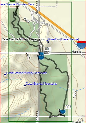
- Providing a 6.3-mile loop hike available from either the Peart or the Arica Trailheads.
- Provide an assessment tool for hikers to rate themselves on their ability to successfully join in on hikes rated anywhere from “A” hikers can finish the loop in about 2 hours.
“B” hikers can finish the loop in about 2 ½ hours
“C” hikers can finish the loop in about 3 hours
“D” hikers probably can’t do the entire loop.
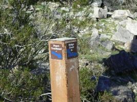
Peart Trailhead
From the intersection of Peart and East Florence Blvd go south toward the I-8 freeway.
Follow the road across Jimmie Kerr Blvd., under I-8 left, then right, followed immediately
by a left (hiker sign) onto the dirt road ¼ mi. to the Trailhead. Porta Potty is available.
Dogs are allowed.
Google Maps directions to Peart Road Trailhead at Casa Grande Mountain
Google Maps directions to Peart Road Trailhead at Casa Grande Mountain
Arica Trailhead
Travel southeast on I-10. Take exit 200 to Sunland Gin Rd. Turn right, then another right,
westbound, onto Arica Rd. just past Love’s. Travel to the trailhead at the end of the road.
Porta Potty is available. Dogs are allowed.
Google Map directions to Arica Trailhead at Casa Grande Mountain
Google Map directions to Arica Trailhead at Casa Grande Mountain
Casa Grande Mt. Park
Assessment hike
From the Peart to Arica Trailheads:
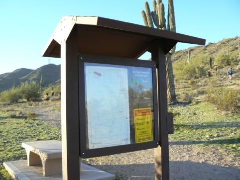
From the Kiosk, hike south on the trail. Ignore the rocky trail that goes to the left
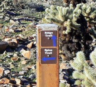
50 ft. from the start and follow the main trail. In 0.16 mi. at the junction go straight across the Spine Trail intersection.
50 ft. from the start and follow the main trail. In 0.16 mi. at the junction go straight across the Spine Trail intersection.
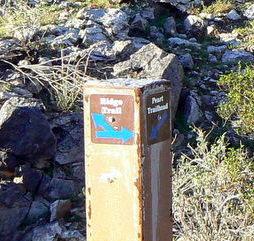
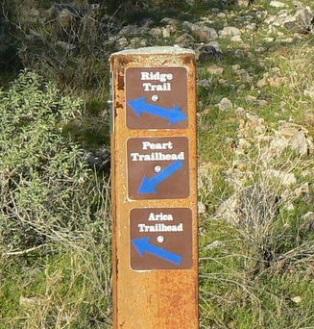
Follow the arrow on the signpost to the Ridge Trail 0.12 mi. Turn left onto the
Ridge Trail (3 min).
Ridge Trail (3 min).
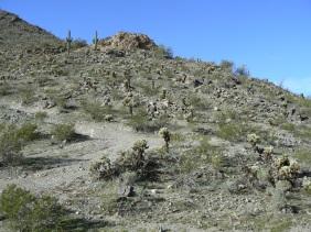
Continue south on the Ridge Trail another 1 mi. past an abandoned road and an
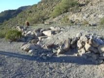
old home site ruins located on a saddle (24 min).
old home site ruins located on a saddle (24 min).
to the Spine Trail Junction signpost (0.26 mi. 7 min).

Continue on the Ridge Trail. In a few yards at another Spine Trail signpost (1 mi. 2 min).
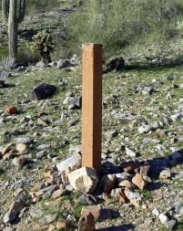
go right on the Ridge Trail. Continue 1.49 miles to the next signpost (no sign on it)
(36 min)
(36 min)
Go left to signpost and turn left to Arica Trailhead ( 0.24 mi. 5 min).

Go left and follow the trail to the Arica Trailhead kiosk (0.11 mi. 3 min).
You have hiked 3.48 miles on the Ridge Trail. Record your time.
And going the other way on the trail
Casa Grande Mt. Park
Assessment hike
From the Arica to Peart Trailheads:
From the Arica Kiosk follow the trail on the right 0.11 miles to the Spine Trail.

Go right and follow the Spine trail northbound, always staying left at any intersection
to avoid the myriad of social trails to the east and cross any roads. At 1.2 miles there
is a signed junction that splits the spine trail. Stay left.

In 0.28 miles turn right. You are on the Ridge trail again for 175 yards. Turn right onto
the Spine trail at the signpost.

Follow the Spine trail northward past an old road crossing the trail to the saddle
(0.2 miles, 4 min).
Follow the trail northward across a couple of old roads for 0.91 miles to the signed
junction (21 min) and go left.
This trail descends to the Peart Trailhead in 0.18 miles (4 min).

You have hiked 2.88 miles on the Spine trail. Record your time.


No comments:
Post a Comment