Showing posts with label Miner's Needle. Show all posts

Saturday, December 4, 2021

Miner's Needle photos Dec 3, 2021


 This is an easy to moderate hike of 5.6 miles in the Superstition Wilderness. The trail starts at the NE end of the Peralta Trailhead parking lot and we take trail #104, The Dutchman's Trail. 

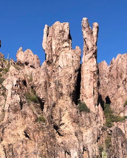
The trail goes up and over the ridge directly ahead, looping around the nose of it to a saddle and into a broad valley. The trail goes generally in an easterly direction across the valley until after about one hour and twenty minutes and 2.6 miles. Here you will see Miner's Needle. This trail meets the Coffee Flat Trail at the junction. As this point, we travel north a short distance for a better view of Miner's Needle and have lunch. We return back on the same trail. Pit toilets are available at the trailhead. 

Directions, Distance and Time to the Trailhead:  Go north on Hwy 79 out of Florence. Drive west on Hwy 60 at Florence Junction. About 8 miles from the junction, at milepost 204.1, is the frist traffic light and a sign, Peralta Trail. Turn right as this light and proceed trhought the residential area and past the school, then on the gravel road ot the trailhead at the end, about 7 miles. It is 62 miles and took 1 hour and 1 mintues. 

All hikers meet at the central mailboxes at about 7:30 am to sign up and pay their membership fee of $10.00 per season, sign a waiver, receive their hiking sticker and have vaccination cards validated. We leave at 8:00 am sharp and return approximately 2:00 -3:30 pm.

Monday, February 10, 2020

February 14, 2020 Miner's Needle/Coffee Flat Trail


This hike was divided up into two groups. 
Jerry lead the medium hike of about 18 hikers on Miner's needle trail. Distance 7 miles.


This picture was taken from the Miner's summit and Bluff Springs Trail 


John lead the long hike on Coffee Flats trail with 5 hikers at a distance of 11.8 miles.


The Miner's Needle Hike and Coffee Flat Trail both start at Dutchman's #104 and lead steadily upward past scenery of various volcanic rock formations and vistas until it meets Coffee Flat Trail #108.  The trail to a view of Miner's needle keeps going to the left on Dutchman #104 (medium hike). The Coffee Flat Trail turns right (long hike). Depending on arrangements, the medium hike may take Coffee Flat instead of Miner's needle. They are both out and back. 


Directions to Peralta Trailhead
From Palm Creek go right out of the park gate to Cottonwood, turn right. Drive 2.7 miles then turn left on Overfield Road and drive 4 miles to Woodruff Road and turn right. Drive 2 miles then turn left onto N Signal Peak Road. Drive 3.6 miles to Highway 87 which turns into 287 for another 8 miles. Turn left at the lights to Attaway Road and drive for 3 miles, then turn right onto W Hunt Highway. Drive 5.6 miles to Highway 79. Turn left on Highway 79 and drive 14 miles to the junction of Highway 60. Turn left (west) onto Highway 60. After about 8 miles turn right at the traffic light on East Peralta Road. Proceed through the residential area and past the school and onto gravel to Peralta Trailhead (about 7 miles). The driving distance is 62 miles.

Thursday, October 10, 2019

November 1, 2019 Miner's Needle Hike - Dutchman #104 towards Miner's Needle

A beautiful day for our first hike. Jerry was the leader today and Montey was the sweep. 


Peralta Trailhead
We started our hike at about 10:00 am onto Dutchman Trail #104. Following the signs for Dutchman #104 and passing the junction with Coffee Flat Trail #108, we started up some switchbacks. We stopped for an early lunch at 11:40, at a spot just off the switchbacks. We returned on the same trail and arrived back at the trailhead at 1:45 pm. It was a nice hike to get the group reacquainted and was a great start to the year. 


Directions to Peralta Trailhead: Leaving Palm Creek main gate, turn right onto Henness Road. Turn Right onto Cottonwood. Next turn is left onto N Overton, then right onto W Woodward, then left onto N Signal Peak, then right to 87(287), then turn right onto N Attaway road at the lights, then right onto West Hunt, then left onto 79 and at the junction of 60 turn left (west) onto 60. After about 8 miles from the junction, turn right at the traffic light on East Peralta Road proceed through the residential area and past the school and onto a gravel road to Peralta Trailhead (about 7 miles). Pit toilets.


Google Maps to Peralta Trailhead.


Length of Hike 6.6 Miles


Saturday, January 26, 2019

Friday 02/01/2019 Miner’s Needle/Coffee Flats

This hike was canceled due to rain at the trailhead. Some hikers went to Casa Grande Mountain for a short hike.


Directions: Go north on Highway 79 out of Florence. Go left (west) on Highway 60 at the Florence Junction. About 8 miles from the junction, turn right at traffic light on East Peralta Road proceed through the residential area and past the school and onto a gravel road to Peralta Trailhead (about 7 miles). Pit toilets.

Google Maps to Peralta Trailhead

Coffee Flat Trail - All Trails


This hike is about 6.5 miles - Out and back hike.


Upcoming hikes
Friday 02/08/2019
Garwood Loop
Friday 02/15/2019
Fat Man’s Pass
Friday 22/08/2019
King’s Canyon Hugh Norris
  Skip’s cell: 503-580-3828     Barry’s Cell: 207-205-4298