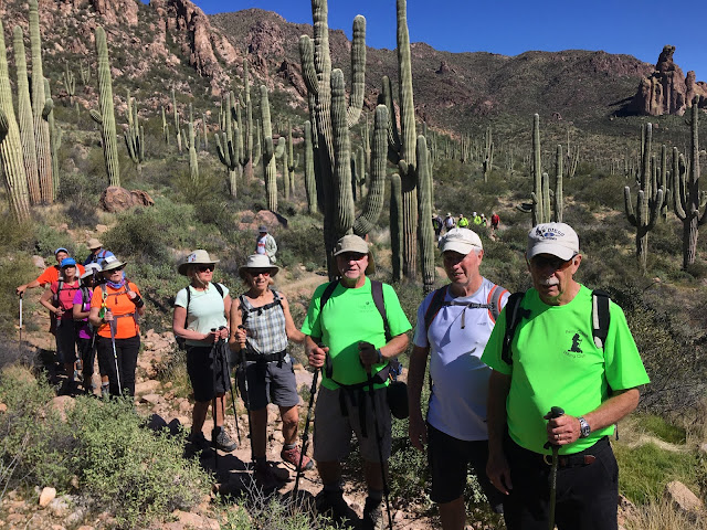
This hike was divided up into two groups.
Jerry lead the medium hike of about 18 hikers on Miner's needle trail. Distance 7 miles.
 |
| This picture was taken from the Miner's summit and Bluff Springs Trail |
John lead the long hike on Coffee Flats trail with 5 hikers at a distance of 11.8 miles.
The Miner's Needle Hike and Coffee Flat Trail both start at Dutchman's #104 and lead steadily upward past scenery of various volcanic rock formations and vistas until it meets Coffee Flat Trail #108. The trail to a view of Miner's needle keeps going to the left on Dutchman #104 (medium hike). The Coffee Flat Trail turns right (long hike). Depending on arrangements, the medium hike may take Coffee Flat instead of Miner's needle. They are both out and back.
Directions to Peralta Trailhead
From Palm Creek go right out of the park gate to Cottonwood, turn right. Drive 2.7 miles then turn left on Overfield Road and drive 4 miles to Woodruff Road and turn right. Drive 2 miles then turn left onto N Signal Peak Road. Drive 3.6 miles to Highway 87 which turns into 287 for another 8 miles. Turn left at the lights to Attaway Road and drive for 3 miles, then turn right onto W Hunt Highway. Drive 5.6 miles to Highway 79. Turn left on Highway 79 and drive 14 miles to the junction of Highway 60. Turn left (west) onto Highway 60. After about 8 miles turn right at the traffic light on East Peralta Road. Proceed through the residential area and past the school and onto gravel to Peralta Trailhead (about 7 miles). The driving distance is 62 miles.


No comments:
Post a Comment