Friday, January 21, 2022

New Blog - See www.palmcreekhikers4.blogspot.com

We have started a new blog for 2022. We will post the Newsletter onto palmcreekhikers4.blogspot.com for upcoming hikes. 

Description, Directions and Pictures will now be posted on the new blog. This Blog will continue to be accessible, as well as palmcreekhikers2.blogspot.com and palmcreekhikers.blogspot.com 


Thursday, January 13, 2022

January 14th, 2022 Long Hike - Fat Man's Pass from Dobbin Lookout, out and back (8.1 miles). Medium Hike - Fat Man's Pass from Overlook, out and back (4.5 miles). Short Hike - Casa Grande Mountain (3-4 miles).


Remember: All hikers meet at the central mailboxes at about 7:30 a.m. to sign up, pay their membership fee ($10.00 for the season), sign their waiver, receive their sticker and have their vaccination cards validated for carpooling. We leave at 8:a.m. sharp and return somewhere between 2-4 p.m. All hikers caravan from Palm Creek to the trailhead with the leader heading the caravan.  A caravan sweep vehicle will be determined at the mailboxes. 

Medium Hike: Fat Man's Pass  Approximately 4.5 miles

Hike the National Trail from the Buena Vista Lookout and the Hidden Valley Trail to Fat Man's Pass. For the most part, this is an easy hike with great views of the Phoenix area. The return trip is more uphill and steeper in parts but they are not too steep or very long. There are some interesting rock formations along the trail in addition to the tunnels and passes you navigate. 

Long Hike: Fat Man's Pass  8.1 miles

Hike from Dobbin's Lookout to Fat Man's Pass hiking the Holbert Trail, the National Trail and then the Hidden Valley Trail to Fat Man,s Pass.

Both the medium and long hikes offer fantastic views of the Phoenix area from South Mountain. Both offer Fat Man's Pass, a very narrow gap between rock faces that hikers must squeeze through (There is a way around if necessary), another narrow gap where you slide under a rock face on a smooth rock, and a tunnel about 100 feet long. Washrooms are available for both groups at the gatehouse and Dobbin's Lookout.

Directions to Medium and Long Hikes

Take I-10 north to exit 155, Baseline Rd. Go left on Baseline and proceed to Central Ave. Turn left on Central Ave. and follow it to the gate at the entrance to the park. Proceed on the paved road to Summit Road and at the top turn left for Dobbin's Lookout. The roads are well marked but narrow and twisting. A good GPS is Dobbin's Lookout 

Short Hike: Casa Grande Mountain 3-4 miles

A short hike around the trails on Casa Grande Mt. led by Denis and Reno. Their hike averages 3-4 miles and they are usually back to Palm Creek by noon. This hike leaves from the central mailboxes at 8:00 a.m. on Fridays and hikers must have a Palm Creek Hiking Club Waiver. Try to be sure to be at the mailboxes by 7:45 a.m. to secure waivers.

January Hikes 

January 21th, Dynamite Trail at San Tan. This is only a medium hike.

January 28th, King's Canyon. Both a medium and long hike.

Remember: If for some reason a hike must be cancelled, you will receive an email by 6 a.m., Friday morning so you can go back to bed!

Jerry's Cell 307-630-0252

John's Cell 207-446-0650


Thursday, January 6, 2022

January 7, 2022 - American Flag Ranch Trail


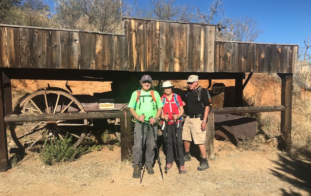
This is a very scenic hike from a roadway just east of Oracle to the Oracle Ridge Trail where we look down on the Biosphere and have fantastic views of Picacho and Table Top. It is also part of the Arizona Trail. The flora and geology in the area are quite different than our normal hikes and the elevation is higher, from 4,400 feet to 5,400 feet. We will stop at the Hi-Jinks mine where Buffalo Bill Cody mined for gold and view the old 1895 Bain 9-A buckboard that was used in the filming of Poker Alice starring Elizabeth Taylor. This is an out and back hike for a total of 7.4 miles and rated as a B-. Hiking time will take approximately 3 hours and 45 minutes. Our return time to Palm Creek is about 7 hours. There is ample parking, however, there are no pit toilets but plenty of bushes.

Directions:

(GPS: Hi-Jinks Ranch)  Take I-10 east to exit 219 for Picacho Peak Rd, turn left to Camino Adelante. Travel 5.1miles and turn left onto E Park Link Dr. After 18 miles, turn right onto AZ 79S and proceed 10 miles to AZ 77 N. Travel south 9 miles and then turn right onto W American Ave. (Signs for Oracle). About 2 miles turn right onto E Mt Lemmon Hwy. and continue 5 miles to Campo Bonito and turn right again on S Highjinks Rd. Trailhead is ahead about a half-mile.

Short Hike:   

Short Hike around the trails on Casa Grande Mt. led by Reno and Denis. Their hike averages 3-4 miles and they are usually back to Palm Creek by noon. This hike will leave from the central mailboxes at 8:00 a.m. this Friday and hikers must have a Palm Creek Hiking Club Waiver. Try to be sure to be at the mailboxes by 7:45 a.m. to secure waivers.

January Hikes 

January 14th, Long Hike, Fat Man's Pass from Dobbin Lookout, out and back. Medium Hike, Fat Man's Pass from Overlook, out and back.

January 21th, Dynamite Trail at San Tan. Medium hike!

January 28th King's Canyon. We will try and see if we can do both a long and medium hike!

Remember:  If for some reason a hike must be cancelled, you will receive an email by 6.a.m., Friday morning!