Wednesday, February 3, 2021

Lost Goldmine Trail from Peralta Road- February 5, 2021

This trail offers an easy walk and an ever-changing view of the multicolored cliffs, escarpments and rock formations of the south side of the Superstition Mountains. There is abundant desert vegetation in the area with a wide variety of trees, cactus and shrubs. About a half-mile from the trailhead the trail passes right by a Saguaro Cactus with a number of arms (?28). Approximately 7.2 miles in and out!

Jerry's Pictures 


Mary Anne's Pictures 


Directions: Travel the back roads like we had for the Hieroglyphic Trail to Florence Junction. West on Hwy 60 to the first traffic light, Peralta Road, and turn right. Proceed through the residential area and past the school, then on the graded road to the Lost Goldmine Trailhead with parking on the left. 


If for some reason a hike must be cancelled, we will email by 6 am on Friday.

Upcoming Hikes:

February 12, 2021 - Hidden Canyon, Bowen, Yetman Trail (Figure-eight) Approximately 6 miles. 

February 19, 2021 - The Gold Mine Trail at San Tan. Approximately 7.2 miles. (Loop) Parking fee $7.00 per vehicle. 

Jerry's Cell 307-630-0252

John's Cell - 207-446-0650


Monday, February 1, 2021

Butterfield Stage Trail January 29, 2021

Butterfield Stage Route Trail - 8 miles

A bit of history from Mary Ann

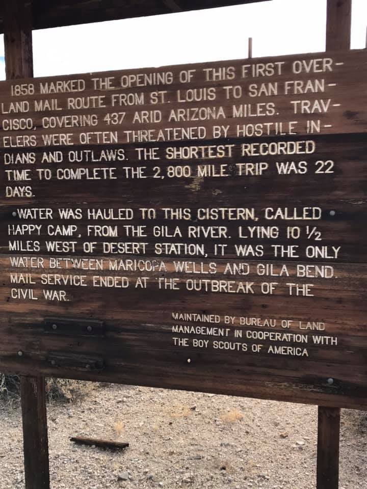
Juan Batista traveled through in 1775 to establish a mission in San Francisco. In 1846, the Mormon Battalion went through to San Diego in the Mexican American War. Pony Express passed through in 1857 and the Overland Stage Route in 1858.

This trail is found in the Sonoran Desert National Monument

John's All Trails Butterfield Pass Afternoon Drive (link will be redirected)

West Butterfield Road Parking area on Sonoran Desert National Monument - Link will be redirected

These photos were taken by John, Jerry and Mary Ann. I have put them in order of time from the photo information except for the first photo. The hike started at about 9:30, arrived at the historical sign at 10:30, had lunch at 11:00 and arrived at the Kimpel Stake Boy Scouts Marker at 11:45.


Trailhead has bathrooms. 


Saturday, January 23, 2021

Cougar Trail and Hieroglyph Canyon - January 22, 2021

Mary Anne's report and pictures of Friday's hike.  Today's lovely hike: Cougar Trail & Hieroglypyh Canyon (but really Petroglyphs) 6.3 miles. Perfect! 

Cougar Trail from All Trails Link


Wednesday, January 13, 2021

January 8, 2021 Brown Mountain near Saguaro National Park

Trip report by John Robichaud. The Palm Creek Hiking Club had its first hike of 2021 on Friday, January 8th. It was a cool clear morning drive to Tucson’s Saguaro National Park. Jerry led us to the trailhead next to the Sonoran desert museum. We then walked the base of Brown Mountain, ascending to the ridge for lunch with beautiful views of the canyons.

Pictures from Mary Anne Wilson


See the previous hike at Brown Mountain in this blog November 2018.  Brown Mountain, Nov 2018

Directions: From Florence Blvd. take I-10 south to exit 236. Turn right and then right quickly, onto Marana Road. Drive one mile and turn left onto Sanders Road, then drive four miles. After stopping at the stop sign, turn left onto Avra Valley Road. Drive one mile and turn right onto Sandero Road. Proceed past the Saguaro Park entrance road to Mile Wide Road and turn left. Follow the signs for the Desert Museum. Travel just past the Desert Museum and turn right to Juan Santa Cruz Picnic area. Follow the one-way road to the south end and park just before it turns back toward the entrance. The trailhead is not marked but is just beyond the picnic tables.