Sunday, December 16, 2018

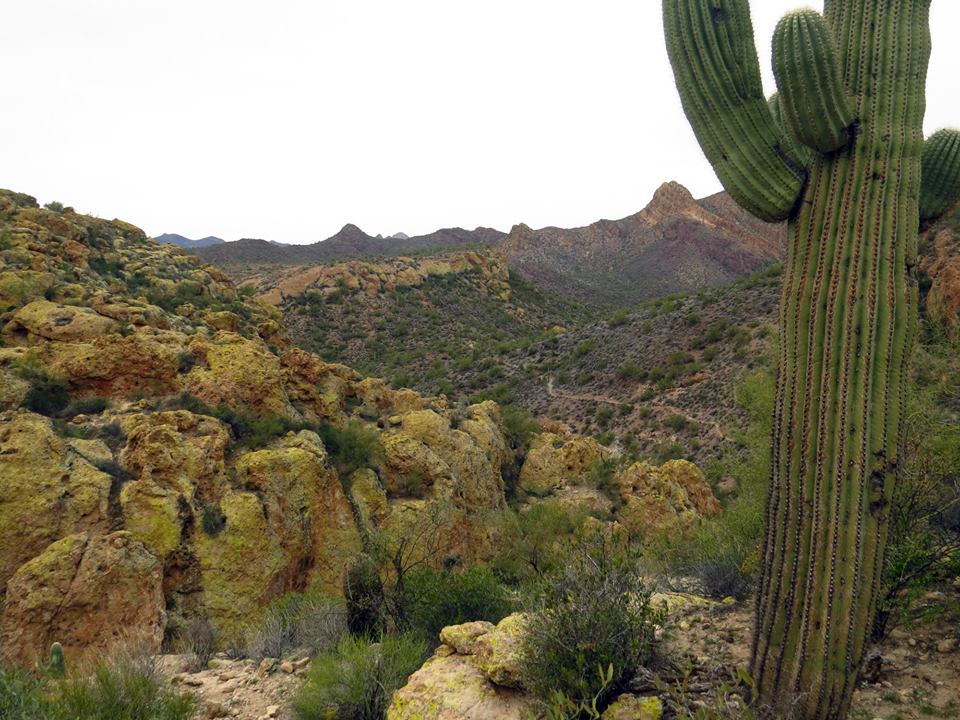
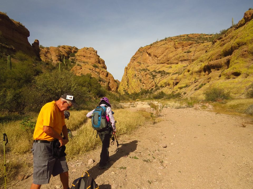
December 21, 2018 Black Mesa/Hackberry Springs and Casa Grande Mountain


Mike's Group


Barry's Group 


Friday Black Mesa/Hackberry Springs Directions:
From the Junction of Hunt Highway and Highway 79 N. of Florence go north on Highway 79. 13 miles to Highway 60. Turn left on Highway 60 and travel 3 miles past King's Ranch. Just past Mountain View Road bear right on E. Old West Highway. Turn right at the stop sign, then bear left continuing on Old West Highway to the first traffic light on Tomahawk. Turn right going northward, past two stop signs, until you come to the junction of Highway 88. Turn right. Proceed past the entrance of Lost Dutchman State Park, to a signed road "First Water Trailhead". Turn right on this dirt road and proceed 2 1/2 miles, past a staging ad parking area for horses and trailers, to the end of the road where there is a good parking area with pit toilets available.

A shorter Friday Hike is at Casa Grande Mountain. See past posts for directions. This group meets at the Parking Lot at Palm Creek at the same time as the other hikers.

    Friday Dec. 28th, 2018
Pima Canyon
   Friday Jan. 4th 2019
Wishbone Junction Loop
Friday Jan. 11th
Thunderbird / Sweetwater

Tuesday, December 11, 2018

Friday, Dec 14, 2018 Baby Jesus Loop and short morning hike at Casa Grande Mountain

Baby Jesus Loop
This is a loop hike at the base of the Catalina Mountains that passes some very interesting rock formations and vegetation. It climbs and loops around through 180 degrees, crossing two major washes and several minor ones before meeting up with the main Baby Jesus trail. That trail leads back to the trailhead via a wash taking the trail to the left of the wash and up the hill to return over a scenic landscape back to the road.  


Mike's Group


Barry's Group


Baby Jesus Loop - All Trails website

Casa Grande Mountain - All Trails

Directions: Take I-10 east to exit 240, Tangerine Road, and turn left. Follow this to the end and turn left onto Oracle Road, #77. Go 3.9 miles to Golder Ranch Road and turn right. Follow this road through a stop sign and over a bridge to where the pavement stops. Just past this point, there is a cattle guard. Go over the cattle guard and immediately turn left onto North Equestrian Road. There is a parking area here that is used for a staging area for mountain bikers. Follow north on North Equestrian Road for 0.5 miles to a corral on your right. Turn right here an go around the north end of the corral. Cars can park here and hikers can hitch a ride in the back of a pickup. Continue on a rough jeep road suitable only for high clearance vehicles to a parking area. 69 miles from Casa Grande. 

Google Maps for driving directions to Baby Jesus Trail


Upcoming hikes: 
  Friday Dec. 21st, 2018
    Black Mesa / Hackberry Springs
       Friday Dec. 28th, 2018
Pima Canyon
   Friday Jan. 4th 2019
Wishbone Junction Loop
Friday Jan. 11th
Thunderbird / Sweetwater


  Skip’s cell: 503-580-3828               Barry’s Cell: 207-205-4298

Saturday, December 1, 2018

Friday Hikes at Casa Grande Mountain

Friday Hikes at Casa Grande Mountain Park.

Meet at the parking lot north of the mailboxes mornings (same time as the longer Friday Hikes) where you meet and sign up. A carpool is organized and the group leaves at 8:00 sharp. These hikes are quite rocky and sometimes the temperature is hot, so we recommend to wear hiking shoes (not running shoes), wear a hat, and bring lots of water.
On Casa Grande Mountain Park there are over 14 different hikes available that are around 3 miles long. These hikes are walked at a leisurely pace, taking time for photos, and discussing the flora, fauna, history or anything of interest. Hikers will be back before noon.

Driving Directions: From Florence Blvd, take I-10 south to exit 200, Sunland Gin Road. Turn right, then turn right again (just past the truck stop) onto West Arica Road. Drive west until you get to a stop sign, then keep going west on the dirt road until you arrive at Arica Road Trailhead. Portable Toilet at the trailhead. 9 miles travelling.


This group will join the Palm Creek Hiking Club to South Mountain on February 15 to experience the short 4.5-mile portion of the Fat Man's Pass Hike on South Mountain. The last hike of the season will be Sunset Vista Trail at Picacho Peak Park on March 15 to take in the poppy bloom. 

See the March Hike on this blog from last year for pictures of Casa Grande Mountain Park.

You are more than welcome to join the Palm Creek Hiking Club for $10.00, but not required since the funds are used primarily for the satellite Spot Emergency Locator devices, not needed locally where cell service is available.
Nancy Archibald - nanc21.na@gmail.com  and 403-896-9899

Wednesday, November 28, 2018

November 30, 2018 - Butcher Jones Trail


Friday, November 30, 2018 - Butcher Jones Trail


This hike as relaxed and enjoyed by all. The vegetation was abundant and green from this year's rains. A well-maintained trail followed the shore of Saguaro Lake (made from a dam on the Salt River). The weather was cool with a sprinkle of rain at the beginning of the hike. Distance travelled was 5.2 miles according to Nancy's GPS.


Mikes Group - This group hiked the same trail as Barry's Group. The two met up at lunchtime. 


Barry's Group and both groups at lunch


Map and Data from Nancy's GPS


Directions: Take I-10 north to Exit 161, AZ 202 to Exit 50 A, 101 N to Exit 51A, AZ 202 to Exit 13, 87 N. Follow 87 N to Exit 199, North Buth Highway. Turn left onto East Butcher Jones Beach Road. 
If you have an "America the Beautiful" Annual Pass or "Golden Age Passport", please bring it along to help with parking. 

See directions from Google Maps on the link below

Google Maps from Palm Creek to Butcher Jones Trail

Trail information:

Alltrails website - Butcher Jones Trail

Question: Who was Butcher Jones? Why is a trail named after him near Saguaro Lake?
  Answer: Butcher Jones is most likely Dr. W.W. Jones (according to state historian Marshall Trimble). An online search showed Jones to be more than a medical professional. In the mid-19th century, he also owned mines and a freighting business in Arizona.  He lived in Yuma, Prescott, Wickenburg, Phoenix and Tempe, and later in life, he became a rancher. He apparently was fairly influential in his day, and he was friends with Jacob Waltz of Lost Dutchman Mine. There also was mention that Dr Jones performed surgeries on his dining room table, which may have led to his nickname of Butcher. A Parks Department employee said of Butcher Jones, "I am pretty sure he was a Doctor, but apparently not a very good one". 
Summary: This is a very scenic hike along the lakeshore, over a wide ridge back down to the lakeshore and up to a bluff overlooks the lake.

Upcoming hikes:
Friday Dec.7th
                Phoenix Mountain Loop
        Friday Dec. 14th, 2018
              Baby Jesus Loop
        Friday Dec. 21st, 2018
              Black Mesa / Hackberry Springs
         Friday Dec. 28th, 2018
Pima Canyon
       
  Skip’s cell: 503-580-3828    Barry’s Cell: 207-205-4298